![](/images/other/stat-length.png)
![Trail Walking Le Vigan - LE VIGAN – CAMPIS - 11.4Km - 04h30 - Dénivelé 392 m - Photo](https://media.geolcdn.com/t/1900/400/ext.pjpeg?maxdim=2&url=https%3A%2F%2Fstatic1.geolcdn.com%2Fsiteimages%2Fupload%2Ffiles%2F1553511878bg_sport_marche.png)
LE VIGAN – CAMPIS - 11.4Km - 04h30 - Dénivelé 392 m
dansmabulle
User
![Length](/images/other/stat-length.png)
Length
12.1 km
![Max alt](https://static1.geolcdn.com/siteimages/upload/files/1508320355ic_sort_altitude_max_24dp.png)
Max alt
436 m
![Uphill gradient](https://static1.geolcdn.com/siteimages/upload/files/1508320355ic_sort_den_pos_24dp.png)
Uphill gradient
392 m
![Km-Effort](/images/other/stat-length.png)
Km-Effort
17.4 km
![Min alt](https://static1.geolcdn.com/siteimages/upload/files/1508320355ic_sort_altitude_min_24dp.png)
Min alt
215 m
![Downhill gradient](https://static1.geolcdn.com/siteimages/upload/files/1508320355ic_sort_den_neg_24dp.png)
Downhill gradient
392 m
![Boucle](https://static1.geolcdn.com/siteimages/upload/files/16400158638029165_repeat_loop_refresh_sync_direction_icon.png)
Boucle
Yes
Creation date :
2014-12-10 00:00:00.0
Updated on :
2014-12-10 00:00:00.0
![Walking](https://static1.geolcdn.com/sitytour/trail-icons/101.png)
3h47
Difficulty : Medium
![Scan this QR Code to open this trail in the SityTrail application](https://capi.geolives.com/qq0zvz2zws4bq2lad0pu/sitytour/trails/244423/qr.png?size=200)
FREE GPS app for hiking
About
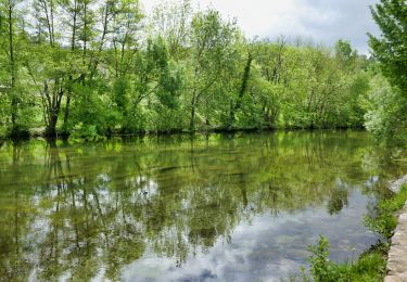
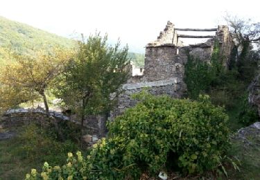
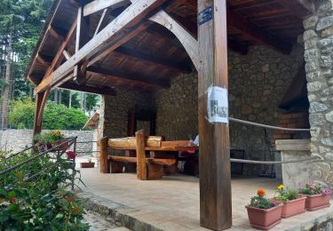
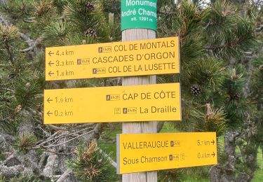
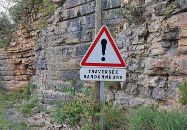
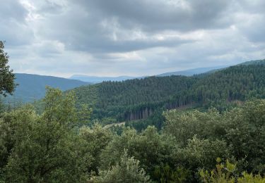
Trail Walking of 12.1 km to be discovered at Occitania, Gard, Le Vigan. This trail is proposed by dansmabulle.
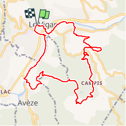
Description
LE VIGAN – CAMPIS
11.4Km - 04h30
Départ randonnée : Village Le Vigan (Gard 30) Cette moyenne randonnée est l'occasion de connaître une partie du pays Viganais. Je ne suis pas à l'origine de ce parcours. Bonne randonnée
Positioning
Country:
France
Region :
Occitania
Department/Province :
Gard
Municipality :
Le Vigan
Location:
Unknown
Start:(Dec)
Start:(UTM)
548424 ; 4871054 (31T) N.
Comments
Trails nearby
![Walking Walking](https://static1.geolcdn.com/sitytour/trail-icons/101.png)
le vigan circuit de l'arre-6km
Walking
Medium
(1)
Le Vigan,
Occitania,
Gard,
France
![](/images/other/stat-length.png)
5.6 km | 6.7 km-effort
1h 27min
![](https://static1.geolcdn.com/siteimages/upload/files/16400158638029165_repeat_loop_refresh_sync_direction_icon.png)
Yes
![Trail Walking Roquedur - Roquedur - Photo](https://media.geolcdn.com/t/375/260/ext.jpg?maxdim=2&url=https%3A%2F%2Fstatic1.geolcdn.com%2Fsiteimages%2Fupload%2Ffiles%2F1553511878bg_sport_marche.png)
![Walking Walking](https://static1.geolcdn.com/sitytour/trail-icons/101.png)
![Trail Walking Molières-Cavaillac - Molières-Cavaillac à Bez-et-Esparon - Photo](https://media.geolcdn.com/t/375/260/ext.jpg?maxdim=2&url=https%3A%2F%2Fservices.sitytrail.com%2FGeolivesWS%2FDownloadMedia.ashx%3FTrailID%3D227203%26Media%3Dfix__20131014115118.jpg)
![Walking Walking](https://static1.geolcdn.com/sitytour/trail-icons/101.png)
Molières-Cavaillac à Bez-et-Esparon
Walking
Difficult
Molières-Cavaillac,
Occitania,
Gard,
France
![](/images/other/stat-length.png)
19.2 km | 29 km-effort
6h 5min
![](https://static1.geolcdn.com/siteimages/upload/files/16400158638029165_repeat_loop_refresh_sync_direction_icon.png)
Yes
![Trail Walking Molières-Cavaillac - esparon_col Mouzoules-17776432 - Photo](https://media.geolcdn.com/t/375/260/ext.jpg?maxdim=2&url=https%3A%2F%2Fstatic1.geolcdn.com%2Fsiteimages%2Fupload%2Ffiles%2F1553511878bg_sport_marche.png)
![Walking Walking](https://static1.geolcdn.com/sitytour/trail-icons/101.png)
esparon_col Mouzoules-17776432
Walking
Very difficult
(1)
Molières-Cavaillac,
Occitania,
Gard,
France
![](/images/other/stat-length.png)
16 km | 25 km-effort
5h 47min
![](https://static1.geolcdn.com/siteimages/upload/files/16400158638029165_repeat_loop_refresh_sync_direction_icon.png)
Yes
![Trail Walking Arphy - Vallée du Coudoulous - Photo](https://media.geolcdn.com/t/375/260/90b23482-1146-4b41-9230-9b53612810b5.jpg&format=jpg&maxdim=2)
![Walking Walking](https://static1.geolcdn.com/sitytour/trail-icons/101.png)
Vallée du Coudoulous
Walking
Difficult
Arphy,
Occitania,
Gard,
France
![](/images/other/stat-length.png)
21 km | 34 km-effort
7h 6min
![](https://static1.geolcdn.com/siteimages/upload/files/16400158638029165_repeat_loop_refresh_sync_direction_icon.png)
Yes
![Trail Walking Arphy - Arphy - Photo](https://media.geolcdn.com/t/375/260/e231fcad-fb6d-4760-a6f9-b9c27668256a.jpg&format=jpg&maxdim=2)
![Walking Walking](https://static1.geolcdn.com/sitytour/trail-icons/101.png)
![Trail Walking Bréau-Mars - Bréau le tour - Photo](https://media.geolcdn.com/t/375/260/04181ca0-7890-4fba-8e38-4c365efc7b61.jpg&format=jpg&maxdim=2)
![Walking Walking](https://static1.geolcdn.com/sitytour/trail-icons/101.png)
![Trail Walking Le Vigan - Le Vigan Nacelles GR7 - Photo](https://media.geolcdn.com/t/375/260/944fa77a-9052-4a0b-8e78-aaa140d1aa33.jpg&format=jpg&maxdim=2)
![Walking Walking](https://static1.geolcdn.com/sitytour/trail-icons/101.png)
Le Vigan Nacelles GR7
Walking
Difficult
Le Vigan,
Occitania,
Gard,
France
![](/images/other/stat-length.png)
25 km | 34 km-effort
10h 9min
![](https://static1.geolcdn.com/siteimages/upload/files/16400158638029165_repeat_loop_refresh_sync_direction_icon.png)
No
![Trail Walking Saint-Bresson - Saint Bresson - Photo](https://media.geolcdn.com/t/375/260/15d7e237-e2dc-49a4-a22d-b2a753ce536e.jpg&format=jpg&maxdim=2)
![Walking Walking](https://static1.geolcdn.com/sitytour/trail-icons/101.png)
Saint Bresson
Walking
Medium
Saint-Bresson,
Occitania,
Gard,
France
![](/images/other/stat-length.png)
14.9 km | 23 km-effort
4h 53min
![](https://static1.geolcdn.com/siteimages/upload/files/16400158638029165_repeat_loop_refresh_sync_direction_icon.png)
Yes